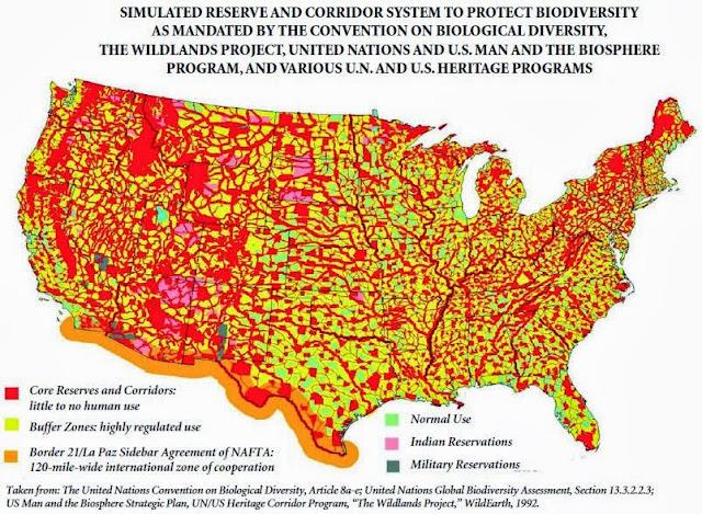
Who wants to bet that if you took the map of the USA that the U.N. has created calling it 'Agenda 30' (2030), and overlaid it with a map of all of these "incidents" that are polluting our environment with hazardous materials - those two maps would probably be close to identical.
(media.greatawakening.win)
FIFTH GEN WARFARE

Where is the map of the "incidents"?
Is it not nice to see strangers and aliens determining what and where you can do in your own country? It really gives the idea of sovereignty, does it not?
UN can eat a bag of dicks.
Red = human activity prohibited, returned to nature. Yellow = buffer zones where human activity is severely regulated. Green = where humans are allowed to live.
Not really a surprise, but all major river systems in the continental US are deep red zones on that map.
Imagine having a dozen mega cities cramming 350 million + among them ( Or whatever smaller number of population left after the vaccine culling and the other planned kill off events occur), and making sure your cities are away from direct access to natural sources of fresh water.
Civilization since the beginning has developed settlements on the shores of fresh water river or lake systems for a reason. This intentional departure from the obvious basic rules of success in human settlement will allow for millions more to be culled by declaring 1 - 2 week droughts in a target city and letting pandemonium among the residents take effect along with deaths from dehydration.
Then again they do have some yellow green in the land of 1000 lakes, so some settlements are not likely planned for water rationing....i wonder what class of people in their NWO planned satanic world would reside in those settlements.
The yellow areas are probably designated for necessary agriculture and industry, with approved workers of these industries being permitted to live on-site. Those red areas will be where the elites and their servants will have their isolated retreats.