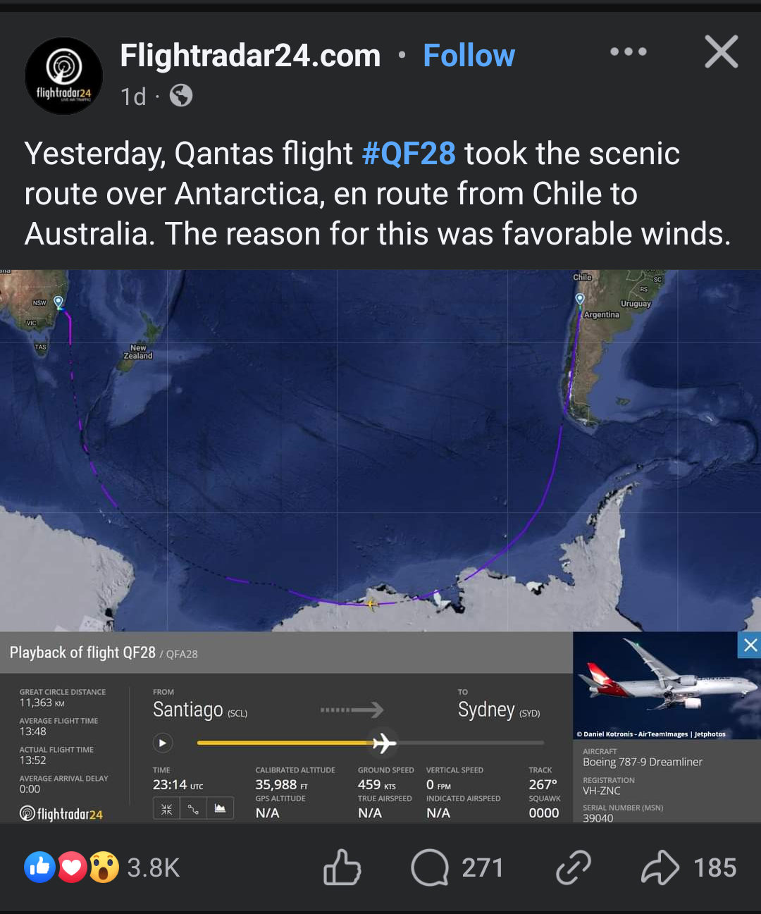
A deviation to the coast of Antarctica is a bit of a stretch, but with prevailing winds, it's not undoable.
EDIT: The projection above in your graphic is a Mercator Projection (I think) and it necessarily distorts shapes of continents, longitude, and latitude so as to depict the 3-dimensional globe on a 2-dimensional map. You wouldn't use that map above to navigate with or you'd get lost.

Looking at this on a flat map, it doesn't seem to make sense.
The earth is NOT flat. Looking at a globe, it's far less dramatic.
What's wrong with saving fuel and time?
With a good tailwind you can throttle back to nothing.
I'll take this down fren, it doesn't seem useful.
The "great circle" direction from Australia to Chili is not what you'd think on the map above... it looks more like this on a globe: https://www.gold-wing.it/moto/2013-10-10-girodelmondo/tappe/ridotte/volo-australia-cile.jpg
A deviation to the coast of Antarctica is a bit of a stretch, but with prevailing winds, it's not undoable.
EDIT: The projection above in your graphic is a Mercator Projection (I think) and it necessarily distorts shapes of continents, longitude, and latitude so as to depict the 3-dimensional globe on a 2-dimensional map. You wouldn't use that map above to navigate with or you'd get lost.
the curve looks extreme on a mercator projection map, but it's really not going that far out of the way. very reasonable route if the wind is there.